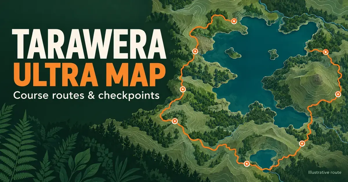
The Tarawera Ultra map is the single most useful planning document for anyone racing New Zealand‘s best-known trail-running weekend in Rotorua. Reading it properly tells you where the wide forestry roads let you settle into a rhythm, where the lakeside single-track slows you down, and exactly where the aid-station checkpoints sit so you can plan food, water and drop bags around them.
The event, officially the Tarawera Ultra-Trail by UTMB, runs five distances across a single mid-February weekend in the Bay of Plenty (the 2027 edition is on 13–14 February 2027). This guide walks through what the course map shows for each distance — the T21, T50, T102, TMiler and the shorter T14 — with the verified elevation, start and finish points, checkpoints and cut-offs you need to interpret the route like a race director. For the wider event background, entry and history, see our complete Tarawera Ultra guide.
Key Facts
- Event: Tarawera Ultra-Trail by UTMB, Rotorua, Bay of Plenty, New Zealand
- Distances: TMiler 163 km, T102 102 km, T50 52 km, T21 23 km, T14 14 km
- Routing: all courses are point-to-point and finish at the Village Green in downtown Rotorua
- When: a single mid-February weekend; the 2027 edition is on 13–14 February 2027
- Terrain: runnable forestry roads and lakeside single-track past eight lakes, the Redwoods and the Te Puia geothermal valley
- Series: part of the UTMB World Series; finishers earn Running Stones toward the UTMB Mont-Blanc lottery
- Official maps & GPX: tarawera.utmb.world
What the Tarawera Ultra course map shows
The Tarawera Ultra map shows five point-to-point courses that all finish at the same place: the Village Green in downtown Rotorua. Rather than repeating loops, each route threads a genuine cross-country journey through native forest, plantation Redwoods, geothermal valleys and the shores of up to eight lakes, including Lakes Tarawera, Okataina, Rotoiti, Tikitapu (Blue Lake) and Rotokakahi (Green Lake).
Because the terrain changes constantly, the map is not just a line on a page — it is a pacing tool. Unlike a road marathon where your effort stays uniform, the Tarawera courses swing between fast, non-technical gravel logging roads and tight, root-strewn lakeside trails that demand full concentration. Knowing which surface comes next is what stops you from burning your legs early. If you are new to the distance, our guide to ultramarathons in New Zealand covers the fundamentals first.
Point-to-point routing, not a loop
Every Tarawera distance is point-to-point. The longer races begin away from town — the T102 starts at Firmin Field in Kawerau, and the TMiler, T50 and T14 start at the Te Puia geothermal valley on the edge of Rotorua — while the T21 starts beside Lake Tikitapu. All of them converge on the Village Green finish. That routing matters for logistics: your finish-line gear, transport and support crew all need to be organised around Rotorua, not the start line.
Reading the trail surfaces on the map
Failing to read the surface changes is the fastest way to blow up early. The soft pine-needle trails under the Whakarewarewa Forest canopy feel effortless and tempt runners into going out too hard, leaving the quads and ankles exposed on the technical lakeside sections later in the day. Use the table below to match your effort to each zone of the map.
| Course map zone | Dominant surface | Main challenge | Pacing tip |
|---|---|---|---|
| Kawerau / Firmin Field | Wide dirt access roads, firm grass | Low — gentle rolling meadows | Hold a smooth conversational effort and conserve energy |
| Lake Tarawera single-track | Exposed tree roots, narrow trail, mud | High — technical footwork | Shorten your stride, lift your feet, prioritise balance |
| Okataina climb | Clay base, loose gravel | High — sustained vertical load | Switch to an efficient power hike; keep shoulders relaxed |
| Redwoods & Sulphur Point | Compact gravel, boardwalk, flat paths | Low — exposed flat sectors | Use road-running mechanics and a steady cadence to the finish |
The five Tarawera distances compared
Choosing your distance is the first decision the map helps you make. The 2026 event introduced a short T14, joining the established T21, T50, T102 and the 100-mile TMiler. The table below compares the verified length, climbing, start and finish, cut-off time and UTMB Running Stones for each course so you can see the step-up between them at a glance.
Distance Comparison
| Course | Length | Elevation gain | Start | Finish | Cut-off | Running Stones |
|---|---|---|---|---|---|---|
| T14 | 14 km | ~161 m+ | Te Puia, Rotorua | Village Green | — | None |
| T21 | 23 km | ~400 m+ | Lake Tikitapu (Blue Lake) | Village Green | 7 hrs | 1 |
| T50 | 52 km | ~1,150 m+ | Te Puia, Rotorua | Village Green | 14 hrs | 2 |
| T102 | 102 km | ~2,300 m+ | Firmin Field, Kawerau | Village Green | 30 hrs | 3 |
| TMiler | 163 km | ~3,800 m+ | Te Puia, Rotorua | Village Green | 36 hrs | 4 |
Running Stones are the qualifying points the UTMB World Series awards for finishing, which feed into the lottery for the UTMB Mont-Blanc finals in Chamonix. The longer the Tarawera distance you complete, the more Stones you bank.
The T102 course map and checkpoints
The T102 is the historic heart of the weekend and the ultimate test of point-to-point strategy on the Tarawera Ultra map. It covers 102 kilometres with roughly 2,300 metres of climbing, starting at Firmin Field in the timber town of Kawerau and finishing at the Village Green in Rotorua, with a 30-hour cut-off. Most of the climbing sits in a series of rolling steps plus one sustained ascent through the native bush between the major lakes.
T102 aid stations and cut-offs
The T102 map is anchored by eight aid stations, which double as the navigational milestones for runners and support crews. In order along the course they are Titoki, Outlet, Otamuri, Rotoiti, Okataina, Millar, Tikitapu (Blue Lake) and Redwoods, before the finish at the Village Green. It helps to break the route into four blocks:
- The opening corridor: leaves Kawerau on wide forestry tracks via Titoki to the Outlet checkpoint, giving the field room to spread out safely.
- The wilderness sector: follows the rugged eastern shore of Lake Tarawera past Otamuri and Rotoiti to the major Okataina hub — the most technical single-track of the day.
- The climbing block: tackles the steepest sustained gradients of the map through to the Millar aid station.
- The home straight: clears Lake Tikitapu and the high-energy Redwoods checkpoint for a flat, fast run into Rotorua.
For times and placings from previous editions, see the Tarawera Ultra results.
The T50 and T21 course maps
If you want the atmosphere of a UTMB World Series race without a triple-figure distance, the T50 and T21 maps deliver the region’s highlights over shorter, faster and more accessible routes. Both share the Village Green finish with the longer races, so the urban finish-line infrastructure is identical.
The T50 geothermal and forest route
The T50 is a highly runnable 52-kilometre tour with about 1,150 metres of climbing. It starts in the Te Puia geothermal valley and passes Rotokakahi (Green Lake) and Tikitapu (Blue Lake) before the Redwoods and the finish. Its four aid stations sit at Puarenga (around 10.5 km), Rotokakahi/Green Lake (around 21.5 km), Tikitapu/Blue Lake (around 35.4 km) and Redwoods (around 45.3 km), with a 14-hour cut-off. Finishers earn two Running Stones.
The T21 short course
The T21 covers 23 kilometres with roughly 400 metres of climbing. It starts beside Lake Tikitapu (Blue Lake), loops the 5.5 km Blue Lake track and heads back towards Rotorua through the Redwoods to the Village Green, with aid stations at Tikitapu (around 6.0 km) and Redwoods (around 15.8 km) and a 7-hour cut-off. It awards one Running Stone and is the most beginner-friendly way onto the course.
The TMiler 100-mile course map
The TMiler is the marquee endurance test on the Tarawera Ultra map: a 163-kilometre route with around 3,800 metres of climbing that circles the Rotorua lakes district and runs deep into the night by headlamp. It launches from the steaming landscape of the Te Puia geothermal valley and travels beneath the sacred volcanic peaks of Mount Tarawera before finishing, like every other distance, at the Village Green. Mount Tarawera is an active volcano whose 1886 eruption reshaped the district; you can read more about how a volcano forms on Wikipedia.
Surviving the 100-mile route
The TMiler combines the technical single-track of the T102 with remote high-country logging blocks, and it carries 13 aid stations — far more than any other distance. Managing your effort over the opening 60 kilometres is the difference between finishing and timing out under the 36-hour limit. Key stages of the map include:
- The geothermal launch: departing Te Puia through the thermal pathways of the Puarenga stream on fresh legs.
- The remote southern lakes: long, exposed sectors past Rotokakahi, the Buried Village and Rerewhakaaitu where weather can shift quickly.
- The night ridgelines: technical forest trail run in darkness — manage headlamp battery life and layers carefully.
- The convergence and finish: joining the T102 flow near Okataina, then tracing the familiar Redwoods and lakefront paths to the Village Green.
Aid stations, nutrition and drop bags on the map
Aid stations are the practical backbone of the Tarawera Ultra map, and planning around them saves you from carrying unnecessary fluid weight. On the longer courses they are spaced roughly every 10 to 15 kilometres and are stocked with water, Näak electrolyte drink (UTMB’s official nutrition), fruit, snacks and — on the longer distances — hot food such as soup and potatoes.
Fuel to a plan rather than by feel. Aim for around 60 to 90 grams of easily absorbed carbohydrate per hour from a mix of gels, chews, drink and real food, and never trial anything new on race day. On the T102 and TMiler you can send drop bags to designated aid stations to refresh gels, socks, layers and a spare headlamp — mark them clearly and pack only what you will genuinely use.
Gear for the Rotorua microclimate
Gear choice on the Tarawera Ultra map comes down to managing a humid, changeable microclimate and mixed footing. Late-summer weather in the Bay of Plenty can swing from hot, sticky forest sections to cool, damp lake edges within an hour, so layers you can add and remove matter more than any single garment.
Your shoes are the most important decision. Because the map mixes hard-packed logging road with slippery, root-covered single-track, a hybrid trail shoe with grippy lugs and enough cushioning is the sweet spot; buy roughly a half-size up to allow for foot swelling. Pair it with seamless synthetic socks and a well-fitted vest — our running hydration pack guide explains sizing and the mandatory kit that longer UTMB distances require, including a seam-sealed waterproof jacket for exposed lake sections.
Training for the Tarawera terrain
Training for the Tarawera Ultra map means preparing for runnable ground, not just steep mountains. A common mistake for road runners stepping up is training only on sharp climbs, which leaves their leg turnover unready for the long, flat, fast forestry sectors that make up much of the course. Your plan should balance climbing strength with sustained aerobic efficiency on flat and gently rolling trail.
A reliable week combines two mid-week easy or tempo runs, one strength or mobility session for ankles, glutes and core, and one long weekend trail run carrying your full race-day vest weight. Build the long run progressively so tendons and feet adapt, and rehearse your nutrition on those sessions. For a broader look at how the event sits among the country’s other big ultras, compare it with the Taupō Ultramarathon.
Common mistakes when reading the course map
Most Tarawera race-day errors are map-reading errors rather than fitness problems. Avoiding these keeps a good day from unravelling:
- Going out too fast on the soft opening trails, then paying for it on the technical Lake Tarawera single-track between roughly 30 km and 50 km on the T102.
- Miscounting aid stations — the T102 has eight, not more, so carry enough fluid to bridge the longer gaps rather than assuming a checkpoint is always close.
- Over-packing drop bags, which slows you down at each stop; pack only decisive items such as socks, gels and a backup light.
- Ignoring the flat finish, where tired runners lose minutes walking sections that are actually fast, runnable Redwoods and lakefront paths.
- Under-preparing for the dark on the TMiler, where headlamp battery life and warm layers are as important as pace.
Where to download the official map and GPX files
The authoritative Tarawera Ultra map, interactive course maps, GPX trail files and aid-station schedules are published on the official event site at tarawera.utmb.world. Download the GPX for your distance onto your watch so you have on-wrist navigation and elevation cues throughout the day, and always check the current runner guide before race weekend, as start times and checkpoints can change year to year.
Sources
Frequently Asked Questions (FAQ)
Where can I download the official Tarawera Ultra map and GPX files?
The official course maps, GPX files and aid-station schedules are published on the event website at tarawera.utmb.world. Download the GPX for your chosen distance onto a GPS watch for on-wrist navigation, and check the latest runner guide before race weekend because details can be updated each year.
Where do the Tarawera courses start and finish?
All five distances are point-to-point and finish at the Village Green in downtown Rotorua. The T102 starts at Firmin Field in Kawerau, the TMiler, T50 and T14 start at the Te Puia geothermal valley, and the T21 starts beside Lake Tikitapu (Blue Lake).
How much climbing is in each Tarawera distance?
Approximate elevation gain is 400 m for the T21 (23 km), 1,150 m for the T50 (52 km), 2,300 m for the T102 (102 km) and 3,800 m for the TMiler (163 km). The short T14 (14 km) has minimal climbing. Most of the ascent comes in rolling steps plus one or two sustained climbs between the lakes.
How many aid stations are on the T102 course?
The T102 has eight aid stations: Titoki, Outlet, Otamuri, Rotoiti, Okataina, Millar, Tikitapu (Blue Lake) and Redwoods, before the Village Green finish. They are stocked with water, electrolyte drink, snacks and hot food on the longer courses, and support crews can meet runners at the accessible ones.
Do I need trail shoes for the Tarawera courses?
Trail shoes are strongly recommended for the T50, T102 and TMiler because the map mixes slippery clay, mud and exposed roots with gravel road. Short, dry-day distances such as the T14 or T21 can be managed in road shoes, but a cushioned hybrid trail shoe with good grip is the safer choice on almost every section.